The City That Rose After the Pumps Stopped
Parts of a major American city were rising. Not because of construction, and not because of geology alone. Satellite observations revealed a slower story—one that began decades earlier when groundwater systems beneath the city were changed.
Read More
The Rock Mass Above the Powerhouse
A large rock mass above critical hydroelectric infrastructure had been moving for years, accelerating and slowing with time. When a major hillside failure later occurred nearby, the satellite record became part of a harder question: what had the slope been saying before the ground came down?
Read More
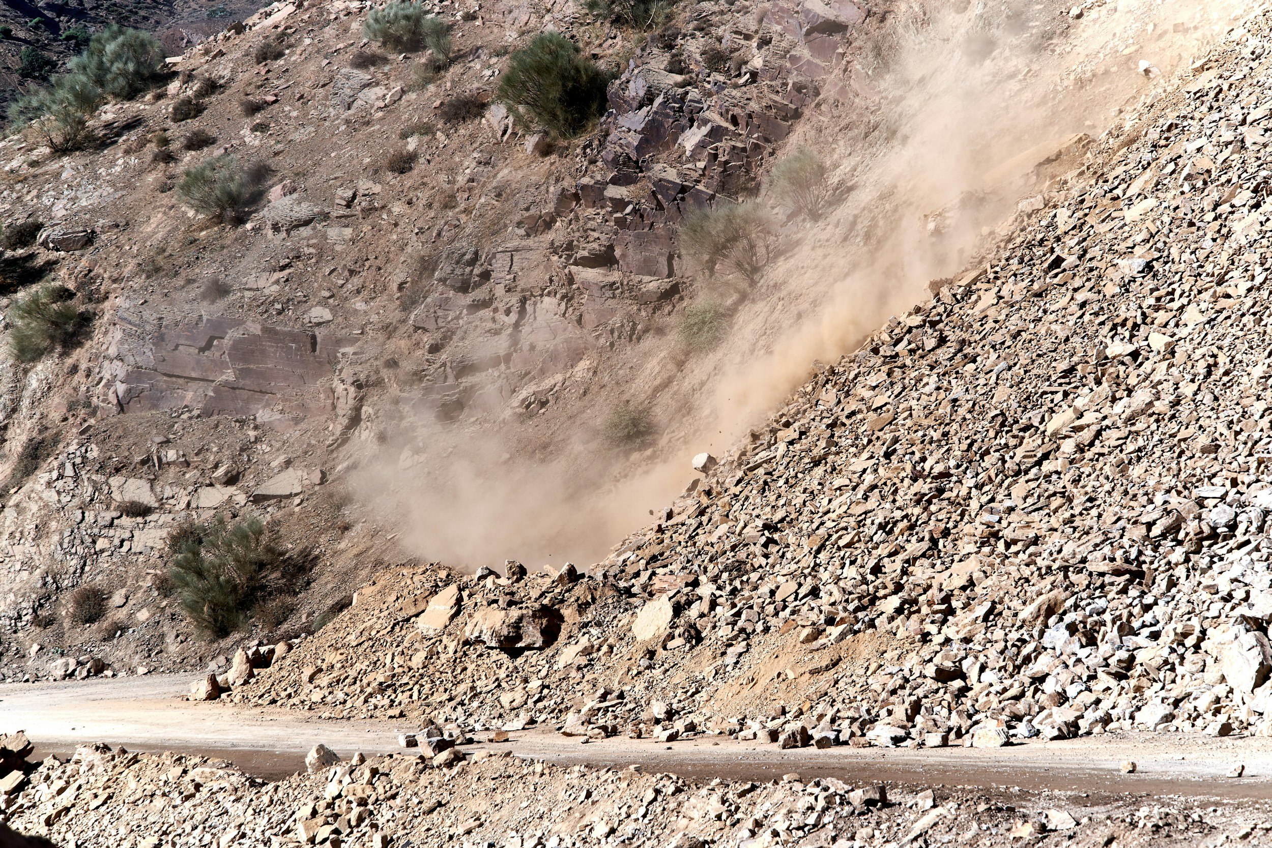
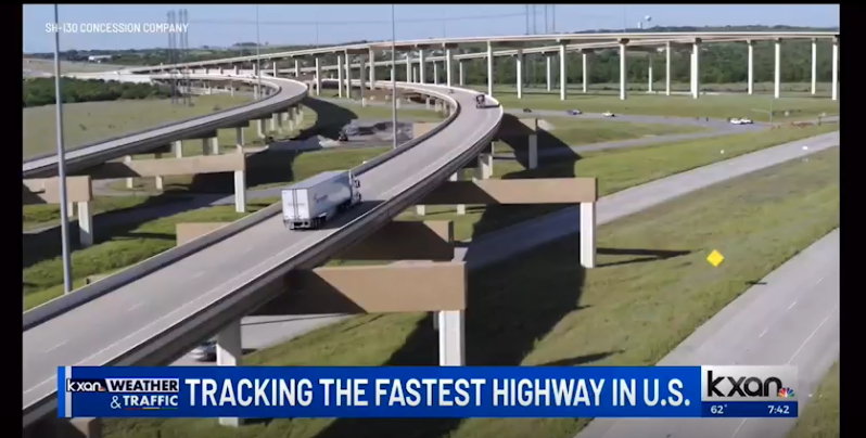
A Highway That Settled Before It Cracked
The roadway looked uniform from the surface, but satellite data revealed something different—localized settlement patterns developing quietly across sections of the corridor. Those patterns saved the operator millions.
Read More
A Dam That Had Been Moving for Years—Without Being Seen
The dam was considered stable. There were no alarms.
But over time, it had been moving—slowly, consistently, and without being seen. Satellite analysis revealed the history that inspections never captured.
Read More
Off the Screen: What EO59 is Reading
At EO59, we spend our days observing how the Earth evolves—but what about the ideas that shape how we think? From childhood classics to thought‑provoking reads, our team shares the books that have stayed with them long after the final page. 📚
Read More
Who Lifted Your Dreams? It's Time to Lift Theirs
Most of us were lifted by someone who never asked for recognition. The Pamela Luise Dream Lifter Prize honors those quiet forces for good — the people who believe, support, and stand beside others when it matters most.
Read More
From Orbit to Operations: How Satellite Radar Is Redefining Emergency Planning & Resilience
Disasters don’t wait for daylight or clear skies. This article explores how satellite radar (SAR/InSAR) is transforming emergency management—revealing hidden risks, enabling earlier warning, and helping leaders move from reactive response to data‑driven resilience.
Read More
NISAR, InSAR: Acronym Soup or Tasty Data?
A great quick look at what is satellite InSAR, what role does the NISAR satellite have in the industry and our reflections on the state of our various acronyms!
Read More
Face to Face: Why Knowing Our Clients Is the EO59 Way
At EO59, we never quote prices without a conversation. Every client's needs are unique, and open communication ensures the right solution-often saving time and money. Our face-to-face approach builds trust, delivers real value, and creates lasting partnerships. Ready to work together? Let's talk.
Read More
Laughing Through the Layers: 10+ Jokes Only EO59 and InSAR Fans Will Get
At EO59, we believe that science and humor go hand in hand—especially when you’re working with data that’s invisible to the naked eye. Whether you’re a seasoned geotechnical guru or just learning what “interferometric” means, we hope this gave you a chuckle.
Read More
One Wild InSAR’ship
Over the past few months, I, Karl Martin Kaseorg, have unexpectedly gone from a regular Estonian high school student - who likes to talk a lot - to a summer intern at EO59. But how did this happen?
Read More
Human InSAR
Truly human InSAR means two promises from us: 1) everything we do is done by a real world person + 2) we will never charge you to talk with us as you gain understanding.
Read More
Becoming Friends with InSAR
A few months ago, the term "InSAR" was about as familiar to me as decoding emojis in a text message from my best friend. It hadn't even brushed past the outskirts of my consciousness. That was until I …
Read More
Sustainability Tech in Orbit
Satellite InSAR has more to offer sustainable development efforts than one may imagine! Learn how our green tech is changing the world.
Read More
The Invisible, Reliable, Daily, Deformation Tool - Satellite InSAR
Satellite InSAR for deformation monitoring in landslides, structures, and surfaces is no new tool. This is a proven technique that should be part of your daily use as a geotechnical, civil structural, and hydrological professional among others working in understanding deformation.
Read More
Pamela Picard, Our Firework!
At the centre of the firework always, a testament to our Pamela Picard who was lost orbiting our local star far too early.
Read More
Happy Labor of Love Day!
This Labor Day 2022 we take a look at the evolution of this day in it’s meaning for us and the love we at EO59 bring to our work!
Read More
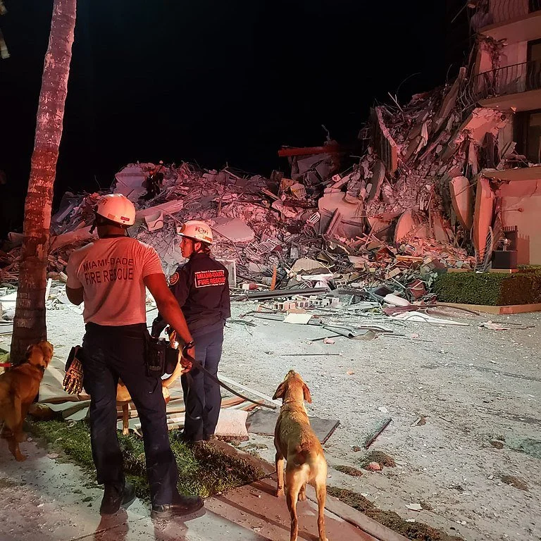
Champlain Towers South Collapse Anniversary
A look back at the tragedy in Surfside, Florida and the use of InSAR in the collapse of Champlain Towers South one year ago. The impact this made on all of us at EO59 as we were contracted to support the emergency.
Read More
Potential Critical Levee Failing Azovstal, Ukraine
EO59 together with Schnabel Engineering - Following up on an Interfax Ukraine bulletin regarding the potential for catastrophic consequences should the levee separating toxic hydrogen sulfide from the Sea of Azov fail, causing an extinction level exposure in the Sea of Azov, we’ve identified, developed, and reviewed the InSAR derived deformation data for the levee.
Read More