

InSAR Data Analysis
Where we truly shine, together.
Satellite SAR Interferometry may sound very complex and you may think that this solution might have little to do with your everyday job. However, if you are interested in monitoring deformation of ground and structures/infrastructures, satellite InSAR can support you.
Our main goal is to deliver this highly complex data in the simplest, lowest cost, most easily used format possible, and empower our clients and partners to do more with it.
Making space accessible, for all of us.
Request for a subscription to our service. The data will be delivered through our web portal and our API, for a perfect integration with your already existing services.
Take a look at our field notes. These are real observations derived from EO59 analysis. Locations and operators are intentionally anonymised.
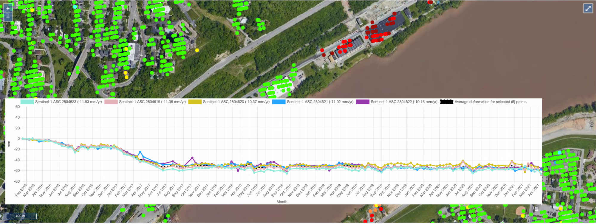
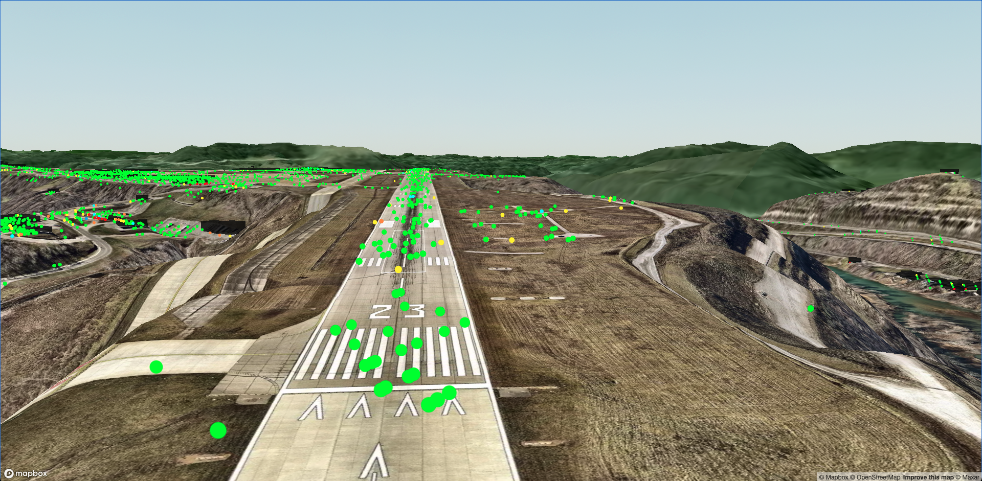
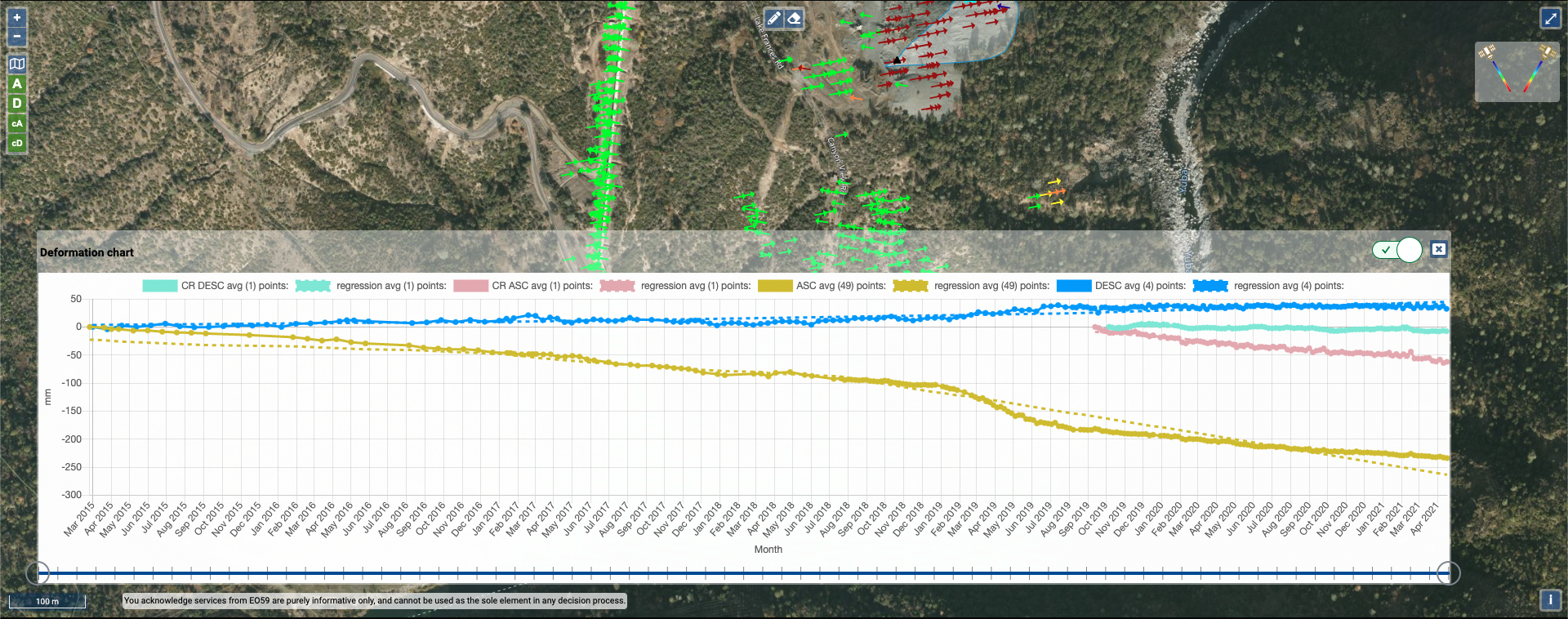
These images are representative of EO59 services and may not depict the actual product.

What you see in these images above is NOT what our tools look like for our clients. It is merely representative. If you’d like to see what you will really get when you work with us - contact us. We enjoy keeping our industry guessing… and giving our clients personal attention. That way we have more fun innovating ways for you to truly understand satellite InSAR data.
Historic analysis
Data from any satellite SAR mission. Like a time machine you can discover if your area of interest was affected by deformation processes in the past.
We will help you discover the range of satellite sources. Naturally, we begin with the Sentinel-1 images, but we go on to many other satellites you may have not even heard of. We regularly employ archives of SAR data from 1992 to the present day. This, along with specialty source data such as SAOCOM, TerraSAR-X, PAZ, ALOS, COSMO-SkyMed, and the upcoming NISAR lend true flexibility. Giving you both cumulative deformation over the period, and a view into when motion dynamics started or changed.
“Was that landslide active in the past?” “When did this deformation process start?” These are some of the questions we may be able to help you answer.
Annual Monitoring
Once an initial historical analysis is performed, we can proceed analysing the new images continuously acquired by the satellite.
This way we can automatically update your InSAR information on your personal account multiple times a month, giving you the ability to remotely monitor the wide area of a site without installing any sensors.