SARPROZ CASE STUDIES

SARPROZ case studies collage.jpg

 Earthquake in Napa, CA

Earthquake in Napa, CA (Sentinel-1 data)

Earthquake in Napa, CA (Sentinel-1 data)

The picture shows an interferogram processed and geocoded by Sarproz over an area in California that includes Napa, where an earthquake happened in August 2014. The fringes in the upper right corner show the ground displacement caused by the event. Data acquired by Sentinel-1.

Los Angeles, CA

Cumulative Displacement detected with TSX data

Cumulative Displacement detected with TSX data

The image shows the total displacement occurred in the observed time estimated by Sarproz from a set of TerraSAR-X data using non-linear time series processing techniques. Red spots are located over oil extraction sites. On the background optical images by Google Earth.

Mosul Dam, Iraq

Dam deformation map and time series example

Dam deformation map and time series example

Click here to learn more about the Mosul Dam Case Study.

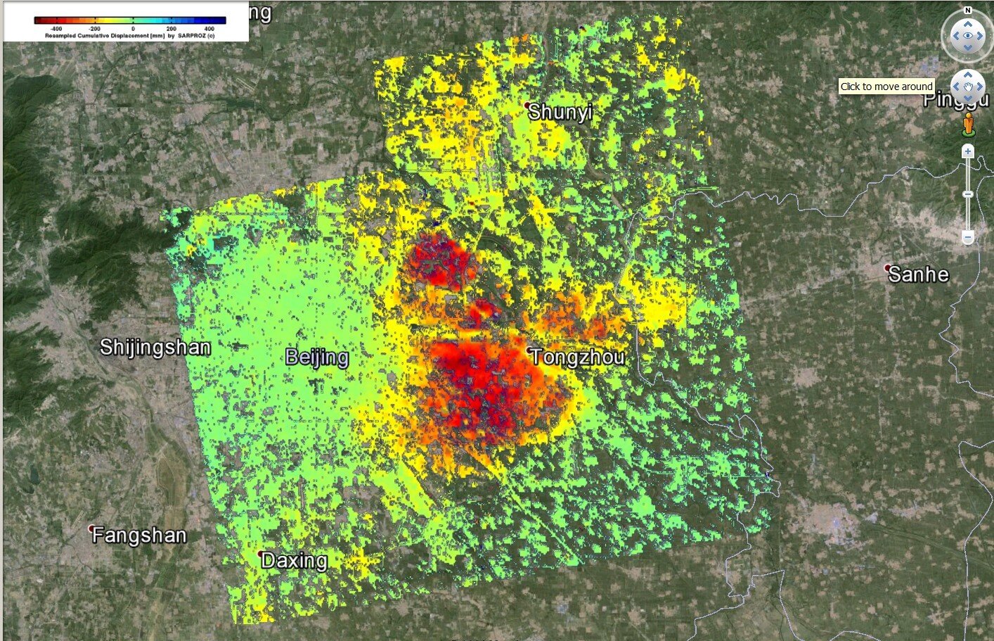
Beijing, China

Cumulative Displacement detected by two parallel TSX tracks

Cumulative Displacement detected by two parallel TSX tracks

Two TerraSAR-X datasets acquired from parallel tracks were processed by Sarproz to estimate non-linear displacement time series. The picture shows the displacement accumulated in the observation period and displayed in Google Earth.

Shanghai, China

Surface subsidence detected after subway tunnels excavation (Cosmo SkyMed data)

Surface subsidence detected after subway tunnels excavation (Cosmo SkyMed data)

Yellow strips in the image show the surface subsidence caused by subway tunnels excavation in Shanghai. The results was obtained by Sarproz using a dataset of Cosmo SkyMed images.


Click here to learn more about the Shanghai Case Study.

Hong Kong

3D View of Urban Radar Targets

3D View of Urban Radar Targets

80 TerraSAR-X images have been processed to detect targets in the city of Hong Kong. Sarproz can export results in different formats and geocode both images and point clouds. Examples here are visualized in Google Earth.

Take a look at all of our Hong Kong Case Studies here.