InSAR for Infrastructure monitoring
Infrastructure projects by national, regional, and municipal governments are increasing, and robust monitoring techniques are needed. This is necessary because most civil infrastructure requires frequent repairs and the recent effects of climate change make monitoring even more important. Currently, the national space agencies and some commercial space companies are providing more high-resolution and daily images that are useful for infrastructure characterization and monitoring.
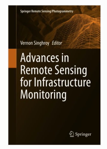
Recent applications on the uses of satellite and airborne images to monitor infrastructure are mainly focused on developing advanced methodologies as well as providing value-added services. To date, my book Advances in Remote Sensing for Infrastructure Monitoring published by Springer in February 2021 is doing very well with over 3000 downloads. This book focuses on modern case studies using high-resolution radar, optical, LIDAR, and UAV images in ten countries on both tropical and temperate terrains. The case studies provide operational guidelines and demonstrate how advanced remote sensing techniques are used to monitor civil infrastructure. It also provides a more detailed account on advanced radar interferometry (InSAR), which is a rapidly growing business area for monitoring infrastructure.
Recent research has shown that satellite radar interferometry techniques are increasingly being used for monitoring rates of land movement triggered by geohazards, floods, climate change, etc. There is an increasing interest in these innovative monitoring technologies by the geospatial, survey and geotechnical communities. The InSAR monitoring techniques are also becoming more widespread and reliable with rapid improvements in image processing, the availability of coherent ground targets and the more frequent revisits of radar satellites. Radar interferometry was developed over the past twenty-five years and is increasingly being used by the global survey and mapping and monitoring industry.
The rapid revisit time of a specific area from the Canadian Radarsat Constellation Mission (RCM) and other SAR satellites allow the bi-weekly measuring and monitoring of millimetre land motion using radar interferometric techniques. The InSAR motion measurements are particularly useful when integrated with GPS, GNSS and RTK, commonly used by surveyors and the geotechnical communities. Time-series analysis of site conditions, such as monitoring installations for volume-changing and deformation analysis is also required by these communities
Radar interferometry represents the phase differences between the backscatter signals in two or more time-series SAR images obtained from similar positions in space. Radar satellites acquire images from repeat-pass orbits. The phase differences between repeat-pass images at a fixed line of sight (LOS) can provide information on topography and small surface displacements. Land deformation measured from SAR interferometry ranges from millimeters to centimeters per orbit cycle. InSAR techniques are used to monitor deformation under specific conditions provided that coherence is maintained over the respective orbit cycle. Using short perpendicular baselines, short time intervals between acquisitions, and correcting for the effect of topography and atmospheric effects, reliable measurements of surface deformation are achieved. The software to process and analyze the InSAR images can be purchased from EO59, who also provides training to use their InSAR software. They are providing InSAR deformation products and services globally including recent the Surfside condominium collapse in Florida.
Explore EO59 Products:
In Canada, for example, we use both Radarsat 2 and RCM images, to measure continuous motion of active slopes affecting critical transportation infrastructure. Other SAR satellites providing InSAR capabilities are also being used by Government agencies and value-added companies such as EO59 and others to monitor critical infrastructures. Two examples are presented to demonstrate the uses of InSAR to complement existing monitoring programs
In Quebec, a landslide threatening a railway uses InSAR to monitor slow slope motion especially during the spring months when the ground is wet. On the densely vegetated low coherence sites, we install metallic reflectors within and outside the landslide area to monitor the landslide motion. The reflectors serve as permanent coherent targets with high radar backscattering and therefore produce an accurate signal to measure the minute land motion. The railway engineers are using the InSAR measurements and other field surveys to target repairs on the railway line and build new retaining walls.
The second example is the monitoring of a landslide within the Canadian Rockies, that is affecting both the Canadian National (CNR) and Canadian Pacific (CPR) railway lines. Pronounced sagging of the retaining wall and the bulging of lock blocks have occurred. The economic importance of this valley corridor, along with the need to understand and manage the safety risk related to the landslides that threaten this strategic transportation route, make this area a priority. Using RCM InSAR techniques, a 1.5 cm sagging near the retaining wall was measured within a 10-day period in February 2020. This measurement was used to target the instillation of additional reinforcements near the railway line.
InSAR techniques is a growth business and will continue to be used by the global geotechnical companies as an important part of their monitoring programs.
Dr. Vern Singhroy, P. Eng., is the President of EOSPATIAL Inc. in Ottawa. He is an internationally recognized expert on remote sensing applications and was the chief scientist of the Canadian Space Agency, RADARSAT Constellation Mission, launched in June 2019. Dr. Singhroy has published over 300 papers in scientific journals, proceedings, and books. He is a professional engineer. He was the editor-in-chief of the Canadian Journal of Remote Sensing, and he is the co-editor of four books, including the Encyclopedia of Remote Sensing. His recent publication Advances in Remote Sensing for Infrastructure Monitoring was published in February 2021 by Springer Press. Dr. Singhroy has been a Professor of Earth Observation at the International Space University in Strasbourg, France (1998-2020) and he is an adjunct professor in Planetary and Space Sciences at the University of New Brunswick in Canada. Dr. Singhroy received the prestigious Gold Medal Award from the Canadian Remote Sensing Society and the Queen Elizabeth Diamond Jubilee Medal for his contributions to Canadian and international remote sensing applications and education.


